Places worth discovering

Things to Do

Find attractions, experiences and places to visit. Events remain the best way to see what is happening on a particular date.

Looking for a dated event? Explore Events

474 places

Explore local places

Broulee Beach

Natural Attractions

Broulee Beach

Situated 20 kilometres south of Batemans Bay, Broulee is a long sweeping beach protected by Broulee Island. This is a favourite beach with tourists, and is ideal for families. It's long sandy shoreline is perfect for stretching your legs on a beach walk. The fishing is great at Broulee, there's good diving and snorkelling in the area and the surfing is some of the best on the South Coast. Broulee Beach is well protected and the sand dips gradually, which makes it a family favourite. Explore Broulee Island, a nature reserve with outstanding views along the coast. The village of Broulee is close by and has options for refreshments, takeaway or eating in.

Broulee NSW

1.2 km away

View place
Group Surf Lesson
Image credit: Broulee Surf School

Sports and Recreation Facilities

The Famous Broulee Surf School

Broulee Surf School was founded in 1996. Surfing is their business and business is swell! They are the longest-running surf school in the Eurobodalla region. The famous beginner surfing lessons are held at Broulee Beach near Batemans Bay. Broulee is regarded as the best and safest learn-to-surf waves on the NSW south coast. It is an unforgettable experience for the whole family.

Broulee NSW

1.3 km away

View place
Snorkelling Candlagan Creek

Natural Attractions

Snorkelling Candlagan Creek

Candlagan Creek, Mossy Point is a favourite spot for children and families in the Eurobodalla and plays an important part in the marine ecosystem with juvenile fish hidden amongst the seagrass beds and mangroves. The estuary extends from the northern end of Broulee Beach to approximately five kilometres inland. At its mouth, Candlagan Creek is quite shallow and sheltered from adverse ocean conditions by a wide sandbar. On its northern edge, there is a grassy bank with shady trees and picnic tables. Being a shallow estuary type environment, it is a good snorkelling spot for beginners with weedy rocky outcrops, marine molluscs, small fish, and small rays common sights. Be aware that the current can be very strong where the creek meets the sea, especially on an outgoing tide, while sharp oysters attached to the rocks can be hazardous to feet. How to get there: Turn off the Princes Highway at Mogo onto Tomakin Road. Follow Tomakin Road to George Bass Drive, and turn right. Shortly after the Tomago River bridge, turn left onto Annetts Parade. Follow Annetts Parade through Mossy Point until it turns onto Beach Road. You'll see a small carpark on the left just before you cross the bridge over Candlagan Creek.

Broulee NSW

1.4 km away

View place
Kayaking Tomaga River

Natural Attractions

Kayaking Tomaga River

A clean, clear river with options for short paddles or a 22 kilometre return trip from Mossy Point to the end of Mogo Creek. Take the eastern tributary at the junction of Jeremadra and Mogo Creeks for this route. The junction is seven kilometres from Mossy Point. Parts of the river are shallow above oyster leases and there is a strong tide near the mouth, so stay in the shallows when paddling against the tide. If you are set up for kayak fishing, the river offers great estuary angling. Protected as a recreational fishing haven, the waterway is renowned for producing quality catches like dusky flathead, whiting, bream, and mulloway. Launch into shallow water near the boat tamp at Annetts Parade but note that this is directly into the river's tidal current. Novices could use the boat ramp at Kingston Place, Tomakin to avoid strong tides near the river mouth. Toilets are near the boat ramps at both Mossy Point and Tomakin.

Mossy Point NSW

1.8 km away

View place
Mossy Point Anchor Lookout

Natural Attractions

Mossy Point Anchor Lookout

Take in the beautiful views over Tomakin, Mossy Point and Broulee from the Mossy Point Anchor Lookout. The lookout and the anchor memorial is located on the headland on the south side of the Tomaga River. The anchor was raised from the Tomaga River where it had served as an aid to navigation in the early part of last century. Down by the river you will also will find a boat ramp, the Boatshed Cafe and kayak hire, and carparking.

Mossy Point NSW

2.0 km away

View place
Snorkelling Broulee Island

Natural Attractions

Snorkelling Broulee Island

Broulee Island is home to some of the best snorkelling on the Eurobodalla Coast, offering clear, sheltered waters and an abundance of marine life. How to get there: Accessible from Broulee, follow George Bass Drive to Broulee Road (which becomes Grant Street), then turn right onto Heath Street, left onto Bayside Street, and right onto Harbour Drive. A convenient car park is located at the end of the road. Two popular snorkelling locations can be found around the island. The first is the sheltered bay near Pink Rocks on the island's north-eastern side. With depths ranging from two to four metres and protection from ocean swell, this area is ideal for beginner snorkellers and families. Snorkellers can explore seagrass meadows that provide habitat for a variety of marine species, including stingrays and the occasional banjo shark. The southern side of Broulee Island also benefits from calmer, protected conditions. Its shallow waters and diverse marine environment make it a rewarding location for both novice and experienced snorkellers. The southern side is an extremely productive area, with different habitats around the reef system such as sand flats, big reef walls and shallow reefs, all combining to make it a superb spot for snorkelling. You may be lucky enough to spot a green turtle, the endangered weedy sea dragon or eastern blue devil fish.

Broulee NSW

2.2 km away

View place
Broulee, North Head to Mossy Point Cycleway

Natural Attractions

Broulee, North Head to Mossy Point Cycleway

Broulee, North Head to Mossy Point Cycleway is a great flat route with a mixture of shared pathways and on-road riding. Park in Heath Street near the Surf Club to begin your journey but really, you can start at any point. Travel south along the back of the sand dunes of Bengello Beach, a renowned surf beach for enthusiasts and locals. This is where you may encounter wildlife. Keep an eye out for kangaroos, echidnas, wallabies, or goannas, as well as lots of birdlife. At the end is the Moruya airport, where you may like to enjoy some extreme adventure like skydiving! Turn around and head north passing the start point, and continuing to Mossy Point; a great place to stop to enjoy much-needed refreshments. Hit the trail for the final leg past popular Broulee Beach back to the beginning. You can enjoy a swim and, if you bring a camera, there is a great lookout near the car park.

Broulee NSW

2.3 km away

View place
Broulee Heritage Area

Historical Sites and Heritage Locations

Broulee Heritage Area

Broulee Heritage Area on the Eurobodalla South Coast has a rich and vibrant history, although much of it is now hidden from view. This was the region's first port. In the 1830s, a sandbar blocked the entrance to the Moruya River, so local settlers loaded and unloaded from ships anchored in Broulee Bay. Surveyed and gazetted in 1837, Broulee had developed a brisk sea trade with Sydney by mid-1841 and became a depot for Jervis Bay's whaling fleet. The port had six buildings and 46 residents, mostly convicts employed by landowner Captain William Oldrey, and was the centre of court and police districts stretching from Jervis Bay to Eden. After a flood scoured out the bar at the Moruya River in 1841, Moruya became the preferred port. The court and hotel moved there in the 1850s and Broulee was abandoned, until holidaymakers discovered it in the 1920s. Explore the story on foot. In the park on the northern bank of Candlagan Creek, a memorial honours the settlers and Traditional Owners who rescued survivors from the wreck of the schooner Rover in 1841. Then walk around Broulee Island, a nature reserve since 1964, to see the site of the 1840-41 Erin-Go-Bragh Hotel and an interesting 1842 grave.

Broulee NSW

2.3 km away

View place
Aerial of the beautiful Broulee Island

Natural Attractions

Broulee Island Nature Reserve Walk

Broulee Island is joined to the mainland by a permanent sandbar and is always accessible. Find it at the southern end of North Broulee Beach or park at Broulee Surf Club and head north around the rocks to Shark Bay, where a short beach walk leads you to the island. Photographers will enjoy the ocean vistas across pristine rock pools. The walk features native plants and is known for birdlife, including the superb fairy wren and white-bellied sea eagle. Length: four kilometres return Time: one hour, two hours including the beach walk Grade: Moderate Start: Walk north from Broulee Surf Club, or south along North Broulee Beach

Broulee NSW

2.3 km away

View place
Jack Buckley Memorial Park and Picnic Area - Tomakin

Natural Attractions

Jack Buckley Memorial Park and Picnic Area - Tomakin

Set on the grassy banks of the spectacular Tomaga River in Tomakin, Jack Buckley Memorial Park is a must for all visitors. This park is the perfect place for a relaxing, well shaded riverside picnic or fire up the barbecue as the kids burn off some of their energy on the playground equipment or basketball court. Toilet facilities and picnic tables also on site. Jack Buckley was a local character who was the local Fire Captain, training young local volunteer firefighters and regularly writing to Tomakin landowners about the fire hazards on their blocks

Tomakin NSW

2.8 km away

View place
Tommo Golf course
Image credit: Tommo Golf

Sports and Recreation Facilities

Tommo Golf

Tommo Golf has a Par 3 Golf course, driving range and newly renovated 18 hole mini golf (putt putt) course. Find all this, just south of Batemans Bay at Tomakin on the NSW South Coast between Mogo and Broulee. Tommo Golf offers a fun golf experience for all ages and skill levels. Club hire available. No bookings necessary,

Tomakin NSW

2.8 km away

View place
Snorkelling Tomakin Cove

Natural Attractions

Snorkelling Tomakin Cove

Tomakin Cove is a protected, sandy cove in Broulee Bay on the New South Wales south coast. Its shallow, lagoon-like water makes it popular with novice snorkellers, groups, and parents with young children. Getting there: Turn off George Bass Drive onto Ainslie Parade and follow it to the end, then turn right onto Red Hill Parade. Park at the Barlings Beach car park below Melville Point, cross the road, and take the track down to the cove. Setting: Tomakin Cove is almost fully enclosed by rocky outcrops and reefs. Rocky platforms extend into the bay on its southern side, while Melville Point shelters the cove to the north. Above water, the surrounding rocks are known for their afternoon colours. Marine life: Snorkellers commonly see stingray species, including stingarees and eagle rays, buried in the sandy seabed, along with schools of small whiting, mullet, and baitfish feeding over the sand. Dense kelp on the seaward side of the cove shelters many small fish, and garfish are common in the deeper gutters near Melville Point. Tomakin Cove's sheltered, shallow conditions make it one of the easier snorkelling spots on the south coast for beginners and young children, while its varied habitats still offer plenty for more experienced snorkellers to explore.

Tomakin NSW

2.9 km away

View place
View from Melville Point
Image credit: Eurobodalla Shire Council

Natural Attractions

Melville Point Lookout

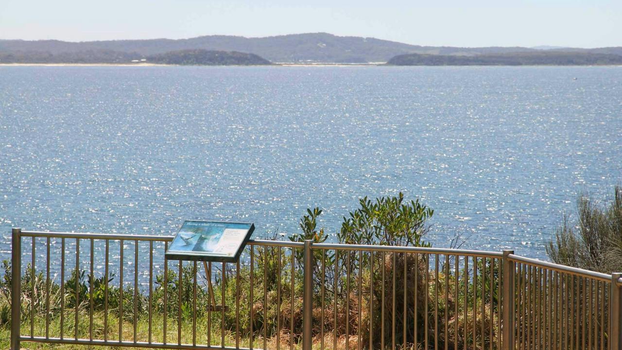
Melville Point Lookout at Tomakin, on the Eurobodalla South Coast, offers beautiful sweeping coastal views over Barlings Beach to the north-east, and Mossy Point and Broulee Island to the south. Tomakin Cove is tucked in against the southern side of the headland. The lookout is a great vantage point for land-based whale watching in season. Melville Point is also known as "Burying Point" and "Gravehead", names that come from the early settler cemetery on the point. The point and its adjoining intertidal rock platform are on the Register of the National Estate as an important geological site. Dogs are prohibited at Cove Beach, and allowed on a time-share basis at Barlings Beach.

Tomakin NSW

3.1 km away

View place
Kipensi and baby Kaius at Mogo Wildlife Park

Zoos, Sanctuaries, Aquariums and Wildlife Parks

Mogo Wildlife Park

Mogo Wildlife Park is situated 10 kilometres south of Batemans Bay. It was established in 1989 and has attained an international reputation as one of the most successful private zoos in Australia with the most diverse collection of exotic wildlife. This extraordinary collection includes gorillas, rhinoceros, silvery gibbons, Bolivian squirrel monkeys, giraffe, zebra, meerkats, cheetah, cotton-top tamarins, snow leopards, Sumatran tigers, Nepalese red pandas, ring-tailed lemurs, oriental small-clawed otters, siamangs and white lions. They have a wide range of memorable up close and personal experiences available. Delivering world standard facilities for over 250 animals, of which more than 44 are rare or exotic species, Mogo Wildlife Park's commitment to the conservation of endangered species is balanced with fulfilling today's visitor expectations zoological gardens. The bushland has been developed into a botanical haven for wildlife and visitors, creating an atmosphere of unity with the natural surrounds and animal enclosures.

Mogo NSW

5.3 km away

View place
Snorkelling Guerilla Bay

Natural Attractions

Snorkelling Guerilla Bay

Guerilla Bay is a snorkelling spot on the New South Wales south coast with clear water and two distinct areas suited to different experience levels. A small rocky island divides the bay: calmer, safer water lies south of the gravel spit, while more adventurous, dangerous water lies north of it. Getting there: From George Bass Drive, turn into Guerilla Bay onto Burri Point Road, then left onto Beach Parade, then right into the beach car park. North side (the pot): This area suits experienced snorkellers only. Access depends on the tide, and jagged rocks must be negotiated to reach the water. In the right conditions, experienced snorkellers consider it worth the effort. South side (sheltered bay): This side is rocky, with a flat reef rising in walls at roughly 35 degrees and sheer walls up to 10 metres. Seaweed-covered rocks and crevices shelter a wide variety of fish, including blue groper, wrasse, and luderick. Marine life: Blue groper, wrasse, luderick, and other reef fish species are commonly seen among the seaweed and rock crevices. Guerilla Bay offers snorkelling for both beginners, on the sheltered southern side, and experienced snorkellers seeking the more challenging northern pot, making it a versatile spot on the south coast.

Guerilla Bay NSW

5.9 km away

View place
Burrewarra Point Lookout

Natural Attractions

Burrewarra Point Lookout

Burrewarra Point Lookout at Guerilla Bay, on the Eurobodalla South Coast, delivers spectacular coastal headland views and is a popular land-based whale watching spot during the annual spring migration, from September to November. It's an easy ten-minute walk from the car park on Burri Point Road to the viewing platform, which looks over Guerilla Bay and north towards Batemans Bay. The track winds through coastal scrub and large, mature banksia trees with twisting branches and knobbly bark. Their distinctive cylindrical flowers bloom from late autumn to early spring, attracting native birds, insects and other nectar-loving wildlife. Just off the main track, a concrete bunker is all that remains of a World War II RAAF radar station. To go further, follow the tracks branching off through the banksia forest towards the headland, marked by a large maritime beacon. Take care here, as the cliff edges are unfenced, so keep well back. The waters to the north and south of the point are protected as the Burrewarra Sanctuary Zone within Batemans Marine Park, which makes the lookout a great place to appreciate the coast's marine life from above.

Guerilla Bay NSW

6.0 km away

View place
Burrewarra Point Banksia Walk

Natural Attractions

Burrewarra Point Banksia Walk

Burrewarra Point has a charming walk through a mature banksia forest with views of the south coast and hinterland. It is a fine place to spot whales from September to November. In autumn, the large grey-green flower spikes of the banksias open, attracting a variety of nectar-eating birds. The cliff edges are not fenced making the walk unsuitable for toddlers and small children. Length: 1.5 kilometres return Time: 50 minutes Grade: Easy Start: Carpark at end of Burri Point Road, Guerilla Bay, off George Bass Drive, south of Batemans Bay

Guerilla Bay NSW

6.0 km away

View place
Clocktower Arcade
Image credit: Artisans Nest

Galleries, Museums and Collections

Artisans Nest Gallery

Artisans Nest is an artist-run gallery featuring some of the region's finest fibre artists and craftspeople. You will find a unique, ever-changing range of original wearable art in luxurious silks and wools, hand made jewellery, soft leather bags, unique felted items and clothing, weaving, gift cards, turned timber vessels, handmade ceramic pieces and art for your home. Artisans Nest has been in operation for close to fourteen years, with new artists regularly joining and contributing to the variety in the Gallery. Now housed in the Clocktower Arcade in Mogo (previously located in the Bodalla Stables), open Wednesday to Sunday and most Public Holidays - See the Facebook page for any closure updates. The gallery is a hub of creative activity, adding to the ongoing development of Mogo as a unique, artisan village.

Mogo NSW

6.8 km away

View place
hand made at Juela Mogo
Image credit: Juela Mogo

Shopping and Markets

Juela Mogo

Juela Mogo is a quaint little manufacturing jewellery studio located in the heart of Mogo just 10 minutes south of Batemans Bay, on the picturesque south coast of New South Wales. The studio’s showroom and workshop have been converted from one of the region’s first settlers cottages (c1860’s) and retain a rustic charm. That synergy of old and new is the fabric from which Juela Mogo draws inspiration. Its décor, which includes an onsite workshop, consultants lounge and custom cabinetry, is unique, just like its team of highly qualified jewellers… and their exquisite jewellery.

Mogo NSW

6.9 km away

View place
Aerial view over McKenzies Beach
Image credit: Eurobodalla Shire Council

Natural Attractions

Snorkelling McKenzies Beach

Snorkelling McKenzies Beach at Malua Bay, on the Eurobodalla South Coast, is for experienced and fit snorkellers only. This small, beautiful, undeveloped beach is enclosed by two headlands, with rocks that ease down to the ocean and form natural reefs. The beach is open to the swell and known for its rugged surf, which can affect visibility, so conditions must be perfect before you enter the water. At the southern end, the amphitheatre around the rocks is a special world of its own, with spectacular rock formations and marine life such as baby cuttlefish. Enter the water around the corner facing Jimmy's Island, where the depth is five to eight metres. At the northern end, wave and current movement has exposed a long, shallower reef to explore, which is well protected in a nor-easter. The track from the car park to McKenzies Beach is also the southern entry point to the Munjip Trail. To get there, drive south from Batemans Bay to the end of Beach Road, then turn left onto George Bass Drive. Just past Malua Bay, watch for a turnoff on the left into a small car park. Dogs are prohibited at McKenzies Beach.

Malua Bay NSW

7.0 km away

View place
McKenzies Beach

Natural Attractions

McKenzies Beach

McKenzies Beach is a small, beautiful, undeveloped beach at Malua Bay, about 14 kilometres south of Batemans Bay, and a firm favourite with locals and visitors alike. When conditions allow, it's a great spot for surfing, body boarding and snorkelling. The beach is also the southern trailhead for the Munjip Trail. An entry sign and whale tail sculpture welcome you as you arrive from the car park, setting the scene for a coastal walk or a relaxed day by the water. The car park is right next to the beach, off George Bass Drive. The turnoff isn't signposted, so keep an eye out. There are no facilities on site, so bring everything you need.

Malua Bay NSW

7.1 km away

View place
Moruya Heads lookout

Natural Attractions

Moruya Heads lookout

Moruya Heads lookout offers superb coastal views taking in the scenic mouth of Moruya River. In spring, bring your binoculars for whale watching as these gentle giants migrate south back towards the Southern Ocean for another summer of feeding on krill. Enjoy a picnic with friends and family in this beautiful part of Eurobodalla National Park. Keep a lookout on the beach as there are plenty of birdwatching opportunities, with the endangered little tern and hooded plover calling the area home. Come spring, Moruya Heads is enlivened with wildflowers, including coastal wattle, banksia and pittosporum for you to feast your eyes on. And, with beaches nearby, you can also seize hotter days with swimming, surfing or a bout of fishing. Close to Moruya Heads lookout is historic Moruya Heads cemetery, where 20 burials are on record and some headstones remain visible. The earliest recorded burial is from 23 August 1858 – a reminder of early European heritage in the area.

Moruya Heads NSW

7.4 km away

View place
Aerial view looking west over Moruya river mouth and breakwall
Image credit: Eurobodalla Shire Council

Sports and Recreation Facilities

Moruya Kayaking Trail - East

The region's rural heritage and unique granite is evident along the banks of this river which winds past the historic town of Moruya. For a 14 kilometre return trip launch into shallow water at North Head campground near the airport, or at the Moruya town boat ramp in Riverside Park, east of Moruya Bridge. Look out for mangrove forests along the way. A short side trip at high-tide up Ryan's Creek, on the southern side of the river two kilometres east of Moruya Bridge, is worthwhile to see the mangroves and granite boulders in the water. Take the left fork at the junction. Toilets are at North Head campground and both picnic tables and toilets are near the Moruya town boat ramp.

Moruya NSW

7.6 km away

View place
Shelly Beach
Image credit: Eurobodalla Shire Council

Natural Attractions

Shelly Beach Picnic Area - Moruya Heads

Shelly Beach Picnic Area at Moruya Heads, on the Eurobodalla South Coast, is a pretty, family-friendly spot at the entrance to the Moruya River, just west of Toragy Point. The crescent-shaped beach faces north towards the Moruya rock wall and Bengello Beach, which keeps it well protected. A walkway from the car park leads to a timber viewing platform overlooking the beach. Behind the sand, the picturesque picnic area has picnic benches, barbecues and toilets, as well as the car park. The beach is not patrolled. Waves average 0.5 to 1 metre over a low tide terrace, with small boundary rips that intensify in higher waves. It's suitable for swimming and is relatively safe close to the beach, but tidal currents and channels form further out and near the entrance walls, so exercise caution. Tidal shoals at the river entrance can also produce a nice left-hand wave for surfing. Shelly Beach is within Eurobodalla National Park, and dogs are not permitted.

Moruya Heads NSW

7.6 km away

View place

What is happening now?

Search dated events, markets, live music, sport and community activities.

Explore Events

Planning by place?

Use Things to Do for attractions and experiences that are not tied to one event date.